

Skip to content
GT Apps
Menu
← All apps
TejasView · Location manager

Your Location Manager — field-ready mapping.

Your map, your data, your view.

From first open to radius checks: welcome, server, sign in, browse, pin, details, live map, and settings — in English, Hindi, or Gujarati.

Native
Android & iOS
Languages
EN · HI · GU
Join
One app, any server
TejasView welcome screen for the location manager app

Everyday tools that keep location work accurate across people and shifts.

  • Photo galleries

    Attach images to a place and review them fullscreen.

  • Comments

    Threaded notes — optional photos — so the next visit starts informed.

  • Basemap layers

    Switch street, satellite, and other server-configured tiles.

  • Location groups

    Bundle related places into named sets for clearer planning.

  • Notifications

    Activity for logins, account changes, and ops updates.

  • EN · HI · GU

    Full UI language switch remembered across sessions.

Product tour

From first open to field-ready

A quiet welcome, a server you join, then lists, pins, maps, and radius checks — shaped for how location work happens.

01 · First open

A quiet welcome before the work begins.

TejasView introduces itself in one beat — locations, routes, cameras — then moves you into the workspace without noise.

  • Clear first-run story, not a cluttered home screen
  • Then connect to the server your admin assigned
TejasView welcome screen for the location manager app

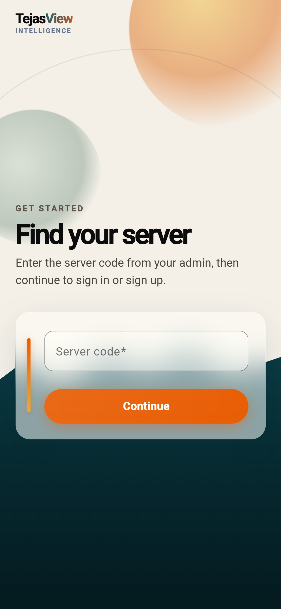
02 · Connect

One app for every deployment you join.

Enter the server code from your admin. TejasView connects to that host — switch anytime and the whole product follows.

  • One app, any server — no separate installs per organisation
  • Change the server and maps, places, and settings follow
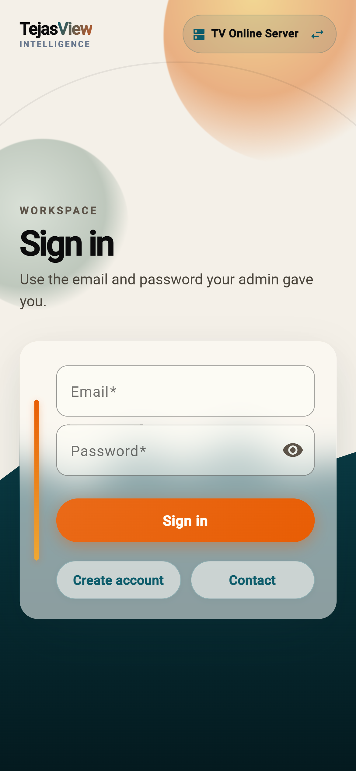
  • Sign in with the email and password your admin gave you
TejasView select server screen with workspace join code

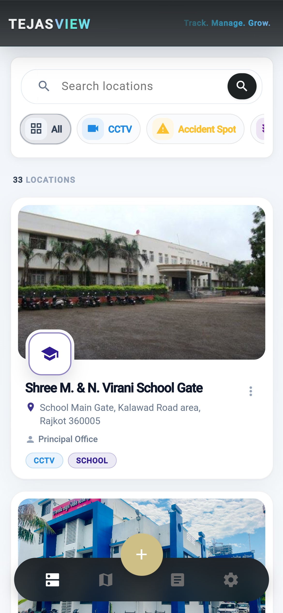
04 · Browse

Find any place without opening the map first.

Search by name, filter by type, and scan cards for address and contact — CCTV, accident spots, and signals stay visually distinct.

  • Colour-coded category pills keep long lists readable
  • Open, edit, or jump to the map from a single row
TejasView location list with colour-coded category filters

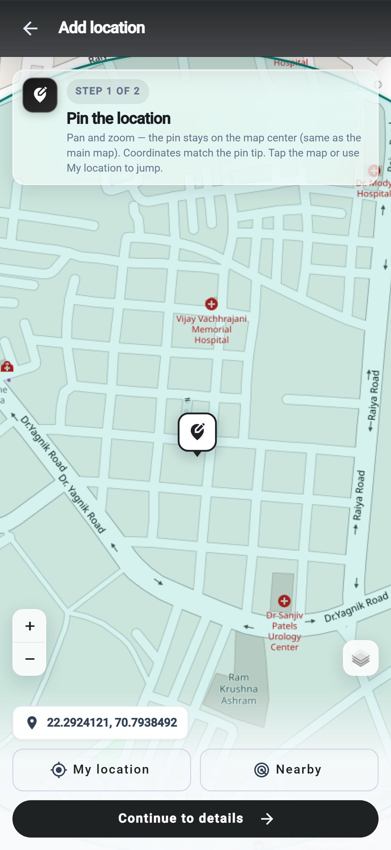
05 · Add

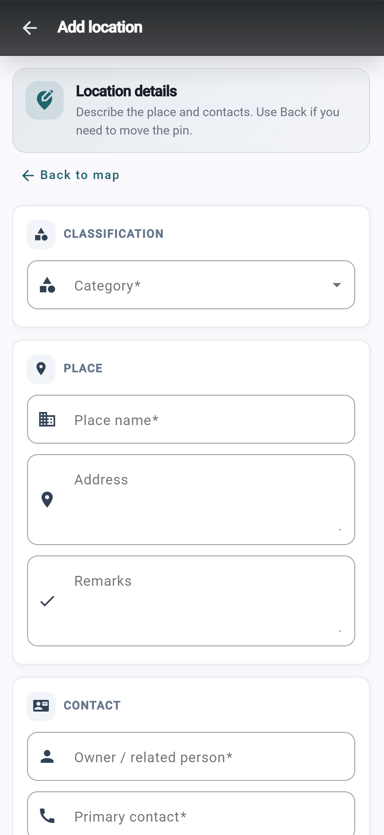
Pin on a full map — then describe the place.

Adding a location is two parts: a large map with live coordinates, then category, name, address, remarks, and contacts.

  • Jump to GPS so field staff don’t guess the pin
  • Nearby places help you avoid duplicates
  • Go back to nudge the tip without restarting
TejasView add location map step with live coordinates

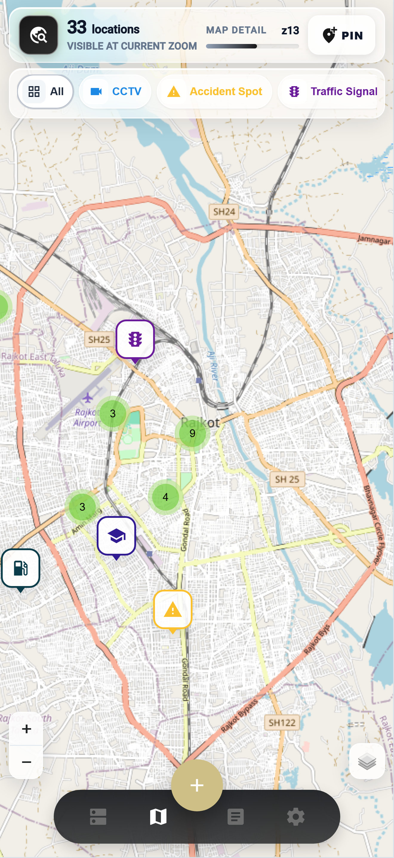
07 · Explore

See the network on one living map.

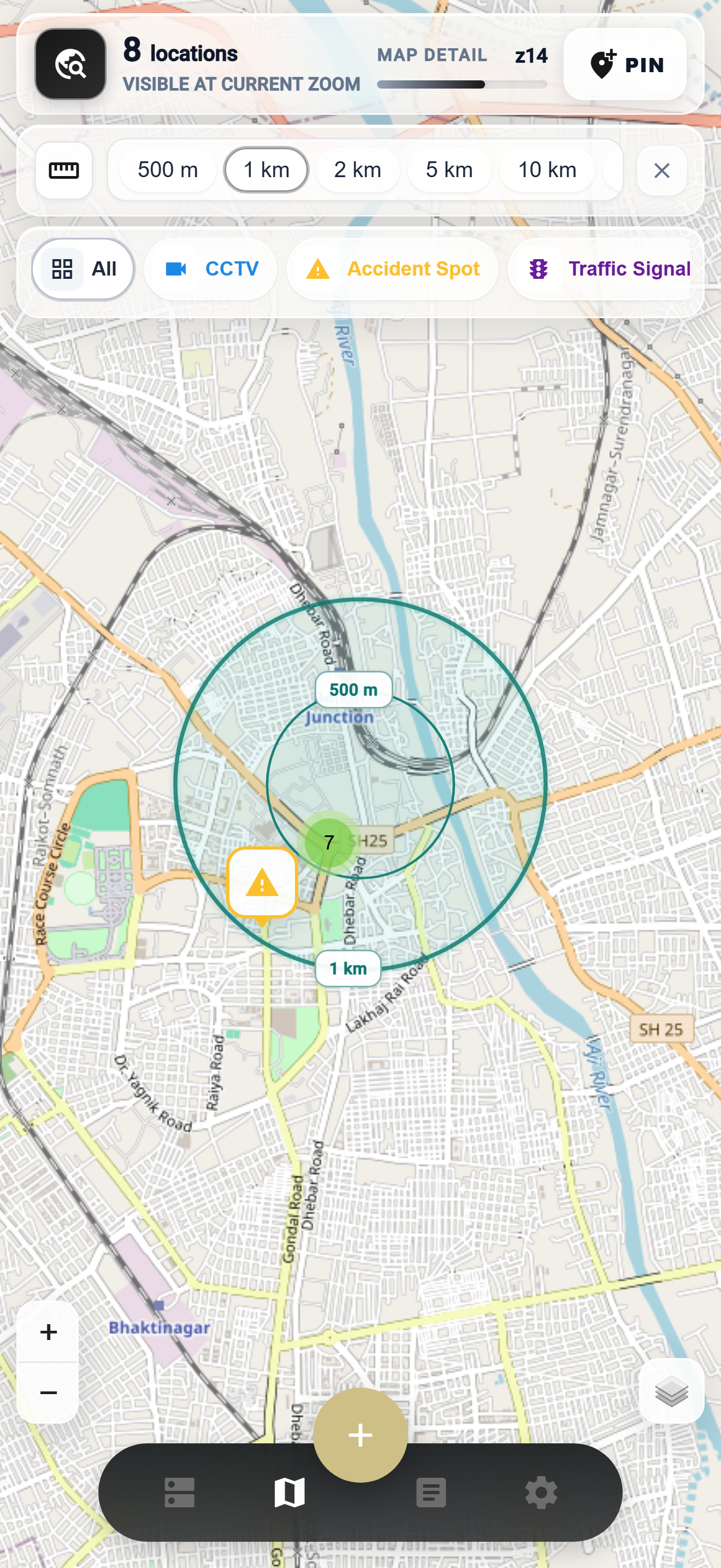
Clusters, colour markers, zoom detail, and basemap layers — dense city data that stays readable. Ask what’s inside a radius from 500 m to 15 km.

  • Marker clustering on busy corridors
  • Visible range rings, not a buried form
  • Combine distance and category for junction checks
TejasView live map with clustered colour markers

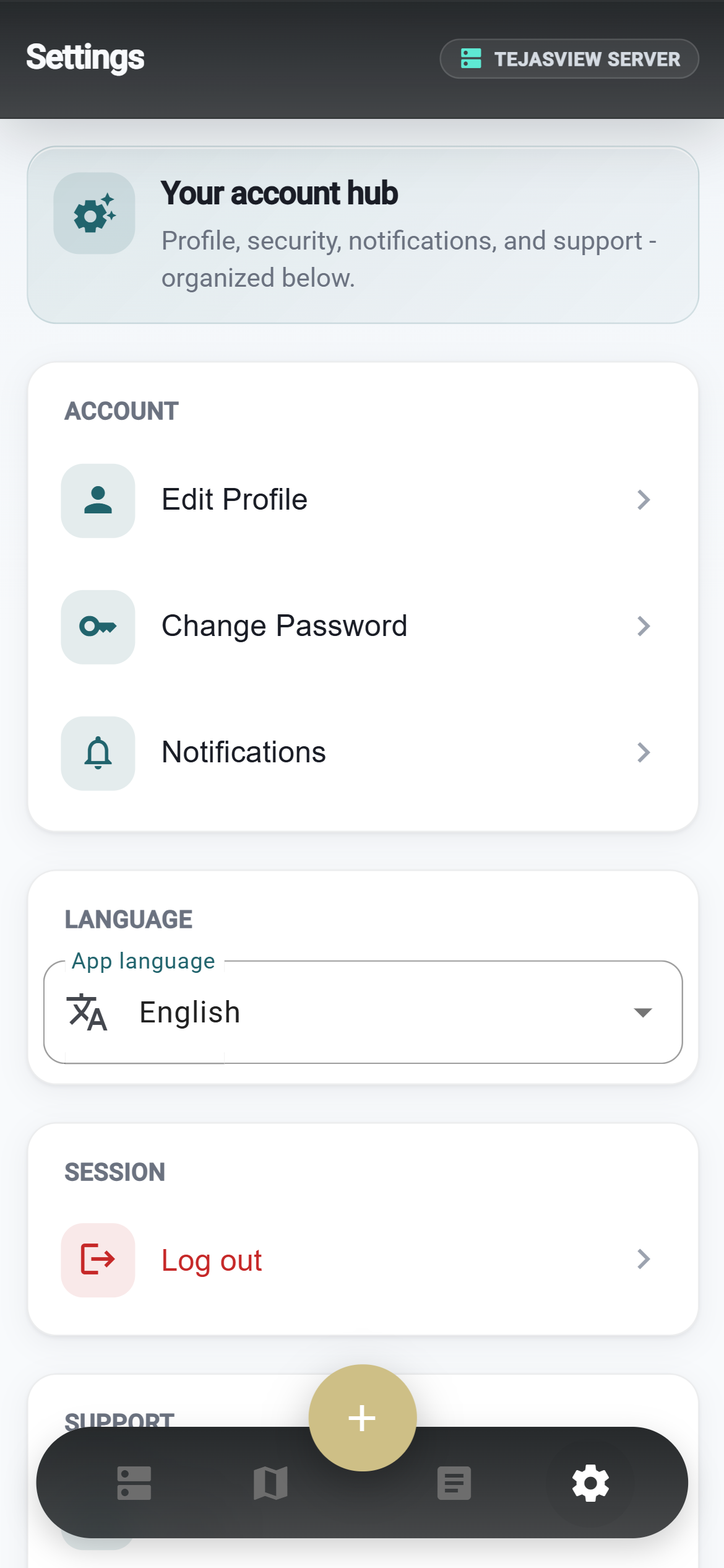
10 · Control

Account, alerts, and language in one place.

Profile, password, notifications, help — and the language your team actually uses day to day.

  • English, Hindi, and Gujarati under App language
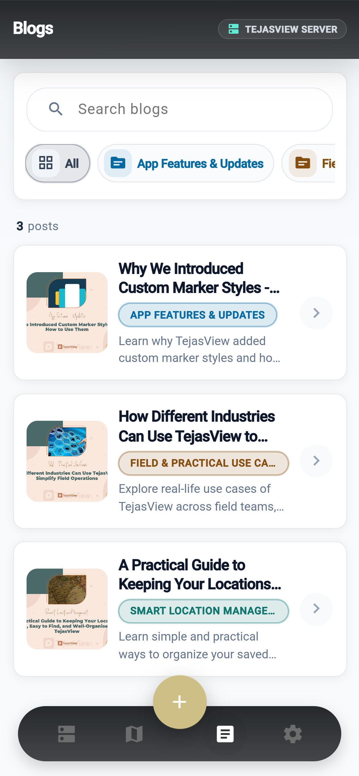
  • In-app TejasTalks blogs without leaving a job
  • Update profile and password on the phone
TejasView settings for profile language and notifications

About TejasView

TejasView Intelligence

TejasView Intelligence turns scattered places into an organised location system. Custom categories, branded markers, and a map built for how your team actually works — from field operations to everyday planning.

Who it is for

  • Field teams that need a shared map of sites, assets, or camera points
  • Organisations that want categories and markers that match their own workflow
  • Individuals who prefer a clean location list and map in English, Hindi, or Gujarati

Mobile app

  • Join your workspace with a join code, then sign in
  • Browse locations on a list or on an interactive map
  • Add and edit places with categories, details, photos, and contacts
  • Open a location for full detail, gallery, and comments
  • Read workspace blogs and manage your profile and language

Operator web dashboard

Alongside the mobile app, operators can use the TejasView web dashboard to manage locations, categories, users, workspaces, map content, and blogs — so the field app stays in sync with how your organisation works.

Get started

Visit tejasview.com for the website and downloads. Google Play is in closed testing (invite-only) until the public listing opens.


FAQ

Questions field teams ask first

One mobile app, a workspace join code, and a map your organisation actually owns.

01 Do I need a workspace to use the app?

Yes — you join with a workspace join code, then create or use your account for that workspace.

02 Which languages are supported?

English, Hindi, and Gujarati in the mobile app.

03 Is there an operator web dashboard?

Yes. Operators can manage locations, categories, users, workspaces, map content, and blogs on the web so the field app stays in sync.

Ready when your team is.

From welcome to radius checks — TejasView is shaped for how location work actually happens in the field.

Partnership

Owned, built, and supported

This app is owned and developed by GujjuTicks, with Seven Infosystem as the client success partner.